The West Foreland Silver Salmon Corridor
The west side of Cook Inlet hosts some of Alaska’s most productive silver salmon habitat, and the West Foreland region stands out as the heart of this fishery. After flying guests here for over three decades, I’ve learned that understanding this landscape—how it functions, why the rivers behave as they do—makes the difference between good fishing and exceptional fishing.
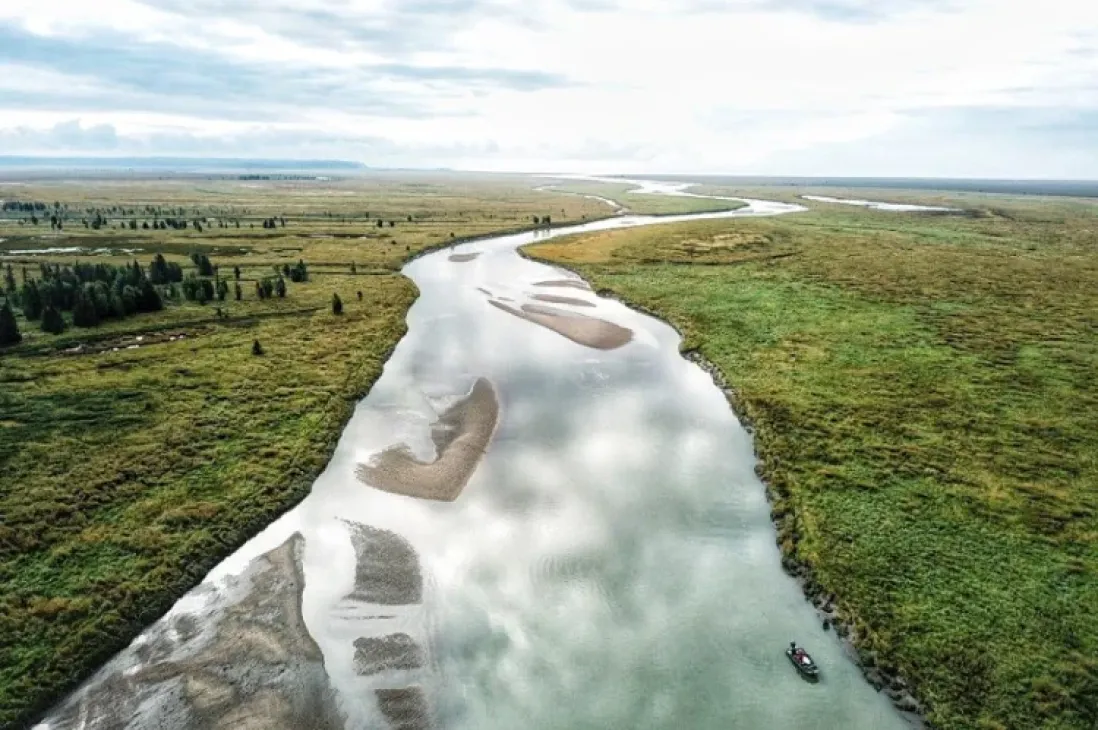
The West Foreland occupies a broad coastal plain between Cook Inlet and the interior mountains. It’s a landscape of meandering rivers, boreal forest, and tidal mudflats that remains largely roadless and undeveloped.
This corridor has been fished by our Alaska fishing guide since 1990, Mark Glassmaker knows it better than anyone.
Ready to fish this corridor yourself? Mark Glassmaker offers Kustatan silver salmon fishing by float plane from Soldotna — one of the most prolific silver-producing systems on the west side of Cook Inlet.
Glacial Rivers and Water Clarity
The rivers draining through the West Foreland carry glacial influence from ice fields in the Chigmit Mountains. This glacial meltwater gives these systems their characteristic turbid appearance—milky gray water where visibility is measured in inches rather than feet.
The glacial flour suspended in the water comes from ice grinding against bedrock. These fine particles remain suspended for miles, making the water opaque. For salmon, this presents no problem. They navigate primarily by scent, locating spawning tributaries even in near-zero visibility conditions.
For anglers, turbid water requires different tactics. Salmon can’t see offerings from more than a few inches away, which is why scent-based presentations work best. Cured salmon eggs fished on the bottom create a scent trail downstream that draws fish from considerable distances.
Glacial rivers change character throughout the day. On warm, sunny days, melt accelerates and rivers rise, becoming cloudier by afternoon. Overnight, when temperatures drop, melt slows and flows stabilize. Fish tend to be most active during stable or dropping water conditions.
Clear-Water Sloughs as Staging Areas
Within predominantly glacial systems, clear-water sloughs provide critical habitat for staging salmon. These sloughs receive water primarily from local groundwater and surface runoff rather than glacial sources, creating zones of clarity within otherwise turbid rivers.
The contrast is dramatic. Where the main river runs opaque gray, sloughs flow clear enough to see the bottom. Silver salmon use these areas to rest and stage before pushing into the heavier current of the main channel.
Clear water also allows different techniques. Flies become effective when fish can see them. Lures and spinners produce aggressive strikes. Anglers can watch salmon move and react, adding a visual element impossible in turbid main channels.
Tidal Influence and Saltwater ProximityBoreal Forest and Wetland Complex
The vegetation throughout the West Foreland creates a unique ecosystem. Black spruce dominates the forest, adapted to wet, poorly-drained soils. Willows line river corridors. Extensive muskeg wetlands—waterlogged peatlands—cover areas between channels.
These wetlands serve as natural water storage, slowly releasing moisture to rivers throughout summer. This buffering effect helps maintain flows even during dry periods. The soggy terrain also limits human access and development, preserving the wilderness character.
Wildlife thrives here. Moose browse willow thickets. Bears follow salmon runs, with activity peaking in late August and September as animals put on weight before denning. Bird life is abundant, from bald eagles to various waterfowl species.
Why Late-Season Silver Runs Excel Here
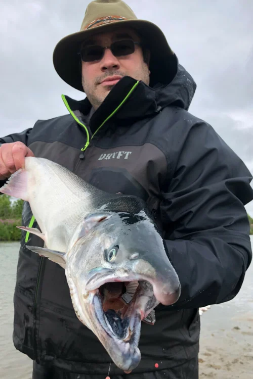 The West Foreland rivers come into their own in late summer and early fall. While road-accessible systems on the Kenai Peninsula see their best silver fishing in August, west side drainages often peak in late August through early September.
Several factors contribute to this timing. The glacial influence keeps water temperatures cool even during warm weather, providing favorable conditions for migrating salmon. The coastal plain setting creates gradual gradients that allow fish to stage comfortably. The limited human pressure means fish arrive in pristine condition.
By the time west side silvers peak, fishing pressure has dropped on more accessible waters. Anglers looking for uncrowded conditions and aggressive fish find what they’re looking for in the West Foreland. The short flight from North Kenai puts you into world-class fishing that most people never experience.
Multiple Drainage Options
The West Foreland hosts several productive silver salmon rivers within reasonable flying distance of Kenai. This provides flexibility in trip planning. If one system runs high and off-color from recent rain, alternative options may fish better.
Having multiple proven systems within a 20-30 minute flight radius creates opportunities that single-river operations can’t match. Weather, water conditions, and fish timing vary, but with several excellent options available, we can consistently put guests on productive water regardless of conditions.
When you fly to the West Foreland for silver salmon, you’re accessing habitat that produces some of Cook Inlet’s strongest coho runs. After three decades of guiding here, I still look forward to every trip—the fishing remains that good. If your interested in a fly-in salmon fishing trip to the Kustatan River call us today!
Mark and Cindy Glassmaker have been married for 28 years, and their business, Alaska Fishing with Mark Glassmaker, has been operating since 1990. Over the past 34 years guiding on the Kenai River, we’ve witnessed many changes. Through early diversification and the dedication of our entire guide staff and team, we’ve built and maintained what we believe is the premier Kenai River fishing experience.
We take great pride in our work and in the reputation our business stands for. Your trip becomes part of that legacy, and we are committed to making it exceptional. Every outing is approached with 100% effort and service, ensuring that your Alaska fishing trips not only meets but exceeds expectations.